
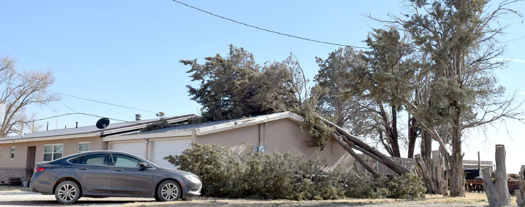
The second powerful winter storm to affect the region, and the country, in less than a week, brought another round of highly impactful weather to West Texas. Sunday (26 February) started off mild, cloudy (and foggy in spots) and moist as breezy southerly winds carried Gulf of Mexico moisture into the southern High Plains. This rare moist start to a West Texas winter day even provided pockets of drizzle, a few light showers and a brief isolated thunderstorm through the morning hours. However, this was only a subtle taste of what was to unfold through the afternoon and evening hours.
The powerful winter storm system, the same one that brought heavy snow and blizzard conditions to very low elevations in southern California, accelerated through the Four Corners and emerged across the central and southern High Plains Sunday afternoon and evening. As this occurred, rapidly deepening low pressure, in cahoots with a dryline and Pacific cold front, turned up the wind dramatically across the entire region. Initially gusty southerly winds not only transported moisture northward, but began to loft enough blowing dust to turn the sky an eerie red/brown by early to mid-afternoon.
Then, as the Pacific front raced out of eastern New Mexico, the wind and dust levels went from unpleasant to downright disgusting and dangerous. Widespread severe (58+ mph) wind gusts lofted copious amounts of dust, dropping the visibility to and below 1/4 mile in most locations on the Caprock through the late afternoon hours. The dust didn’t stop at the edge of the Caprock, but instead swept through the Rolling Plains during the evening, eventually moving on into Oklahoma and North and East Texas. The thick dust persisted for quite some time, and aside from the color and feel, had the appearance of fog given the persistent low visibility. Unfortunately, the thick dust make travel difficult to impossible and contributed to several accidents around the region.
When the cold front overtook the dryline, widespread showers and thunderstorms filled in over the southeast Texas Panhandle into the Rolling Plains. The storms did provide a little rain in spots as a quick-moving line raced eastward, but they also enhanced the wind and a few locations even experience hail, as large as golf balls in Memphis.
Wind gusts of 60 to 80 mph were common with the strongest thunderstorm activity, but the West Texas Mesonet site one mile northeast of Memphis recorded an impressive 114 mph gust. Thankfully, this magnitude of wind appeared quite localized, though the town of Memphis did have some damage, both from the wind and wind-driven hail. Several windows were broken, roofs were damaged and carports were destroyed.
The damaging winds weren’t confined to locations where the thunderstorms moved through. Instead, wind gusts of 60 to 80 mph were common across the Caprock from the late afternoon through the evening hours before gradually dropping to breezy levels by early Monday.
The Lubbock Airport officially measured a peak wind gust of 77 mph at 7:20 pm. The resulting thick blowing dust dropped Lubbock’s visibility to at or below 1/4 mile from 5:53 pm to 7:14 pm, with zero visibility observed from 5:57 pm to 6:10 pm. The visibility finally recovered above 1 mile at 8:04 pm, but didn’t improve above 6 miles until 4 am on Monday.
Behind the dryline, the intense winds and warm and much drier air created a period of critical fire weather. These conditions supported the ignition and spread of several wildfires on the South Plains, including one west of Levelland and a second in northwest Lamb County ( west of Springlake). Smoke plumes from both of the fire listed can be seen clearly in the radar animation located several images above.
On the positive side, the thunderstorms did bring a little rain to the region, primarily the southern Texas Panhandle and eastern Rolling Plains. Even where the storms raced through, rain totals generally ranged from a few hundredths to a quarter inch. Childress officially record 0.18 inches of rain, while Lubbock only had a trace.